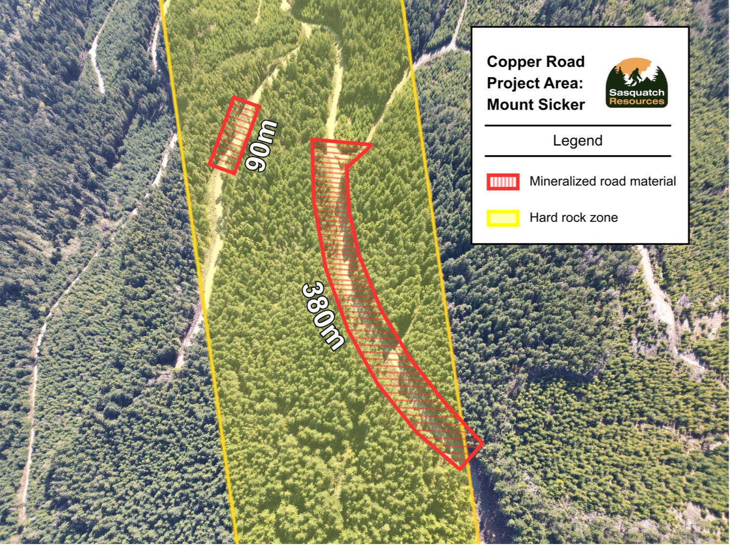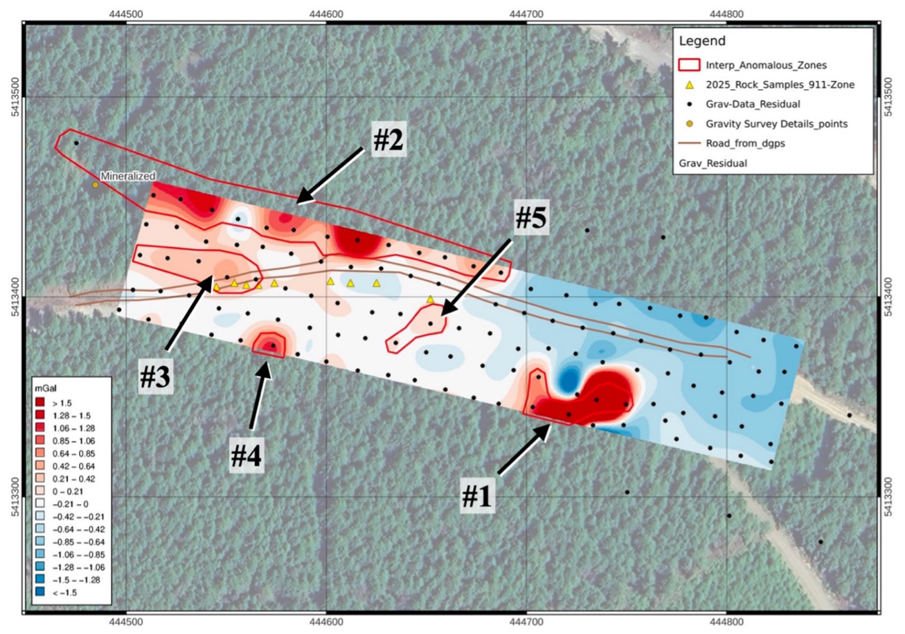
INSERT MAPS
Large zones of high-density rock in and around the road, all to 20m depth (the depth limit of the survey). Exposed mineralized rock sampled thus far averaging 2.36% Cu.
A near-surface copper system approximately 2km from the Mount Sicker waste site, with both waste rock and hard rock possibilities. Waste rock: a significant volume of high-grade waste, where a logging road was cut, and quite literally built, out of mineralized rock. Hard rock: substantial in-ground mineralization extending across both sides of the road (for future hard rock deposit potential).
Two to three kilometres from the original Mount Sicker workings, recent logging cut new roads straight through mineralized ground. The exposure sits on the largest geophysical anomaly on the mountain, with copper mineralization mapped from surface to roughly 200–250 metres.
Sampling of the road base: a 48-sample grid averaged 0.98% Cu.
Sampling of the adjacent hard rock: nine channel samples over 24.7 metres averaged 2.36% Cu.
A trenching and bulk-sampling permit is in hand, and a 2026 gravity survey has shown a significant system (see below).
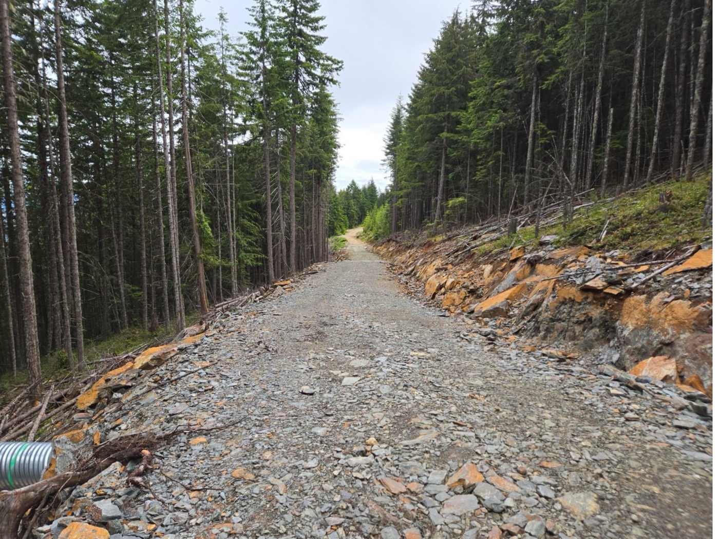
Large zones of high-density rock in and around the road, all to 20m depth (the depth limit of the survey). Exposed mineralized rock sampled thus far averaging 2.36% Cu.